
8.9 Grid to Ground
When GPS and total station work together, it is usually necessary to modify the distance measured by the total station so that it is consistent with the distance projected onto the Gaussian plane by GPS measurement. If GPS or total station work alone, there is no problem with distance modification. Near the central meridian, the distance modification value is small, and the farther away from the meridian, the larger the distance modification value. If you want to avoid distance modification, you can appropriately reduce the projection bandwidth. When providing coordinate results, special explanations should be made to ensure the accuracy and reliability of the data.
The following equation is the formula for calculating the distance D from the length S of the geodetic line to the straight line on the Gaussian plane. It can fully meet the requirements for the reduction of first-order side lengths, and can be omitted for the reduction of second-order side lengths. For the reduction of third and fourth-order side lengths, it can be further omitted

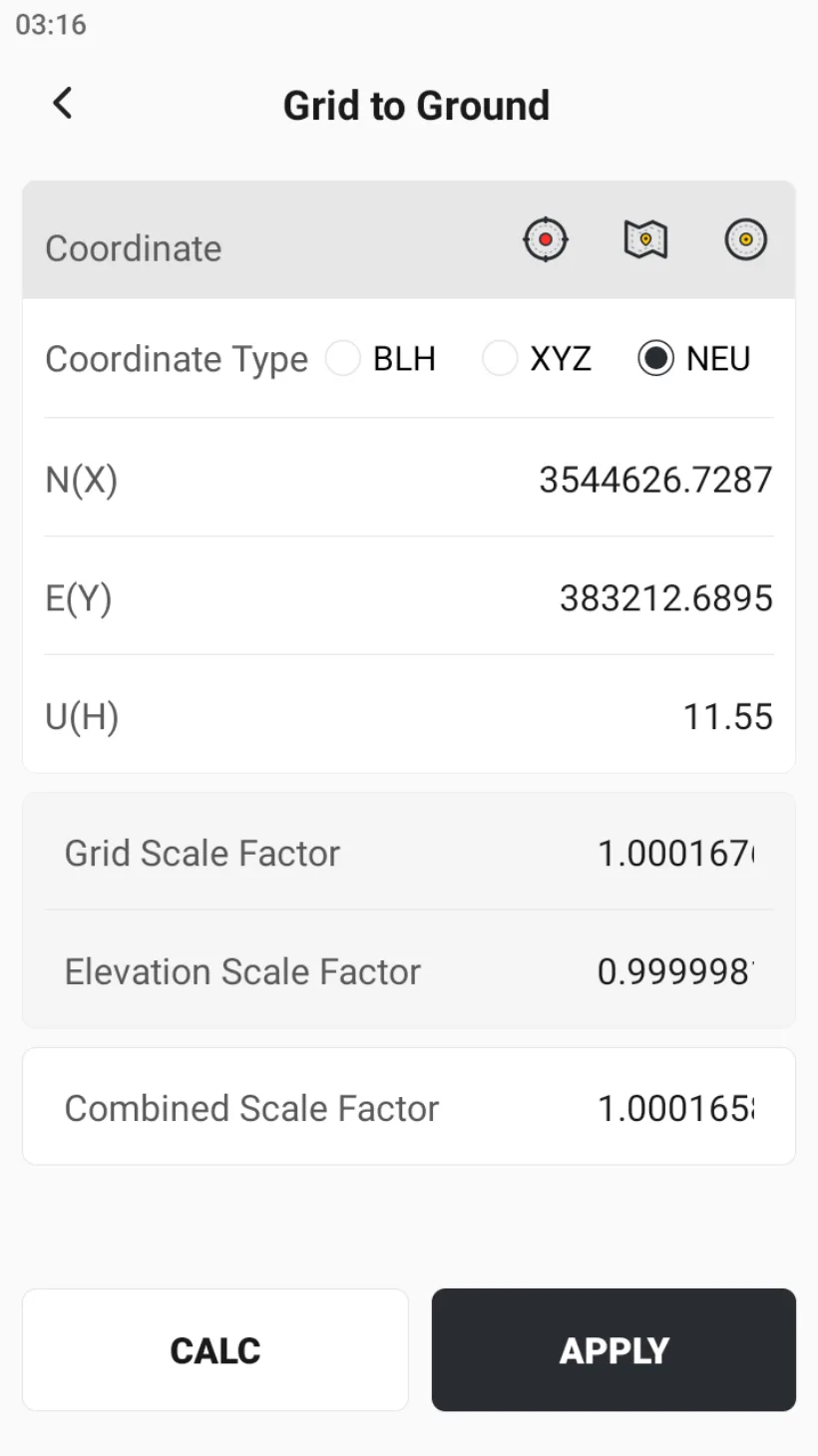
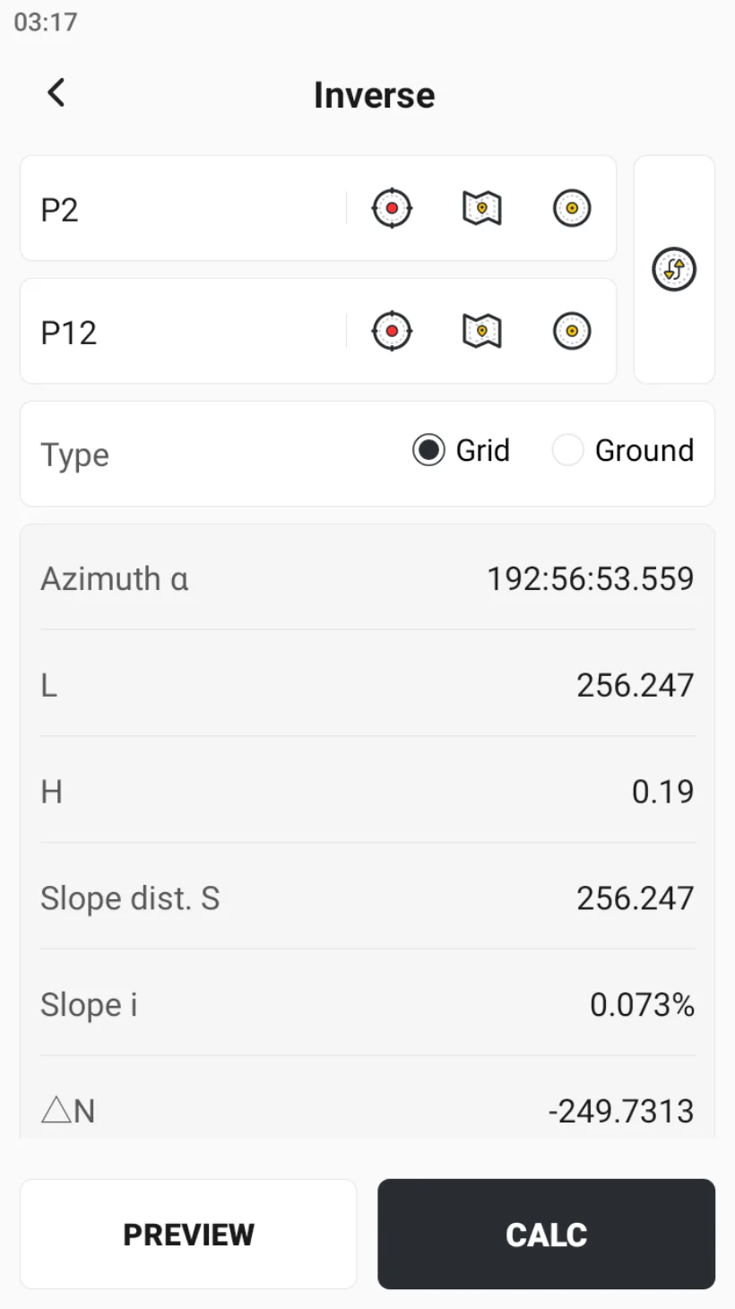
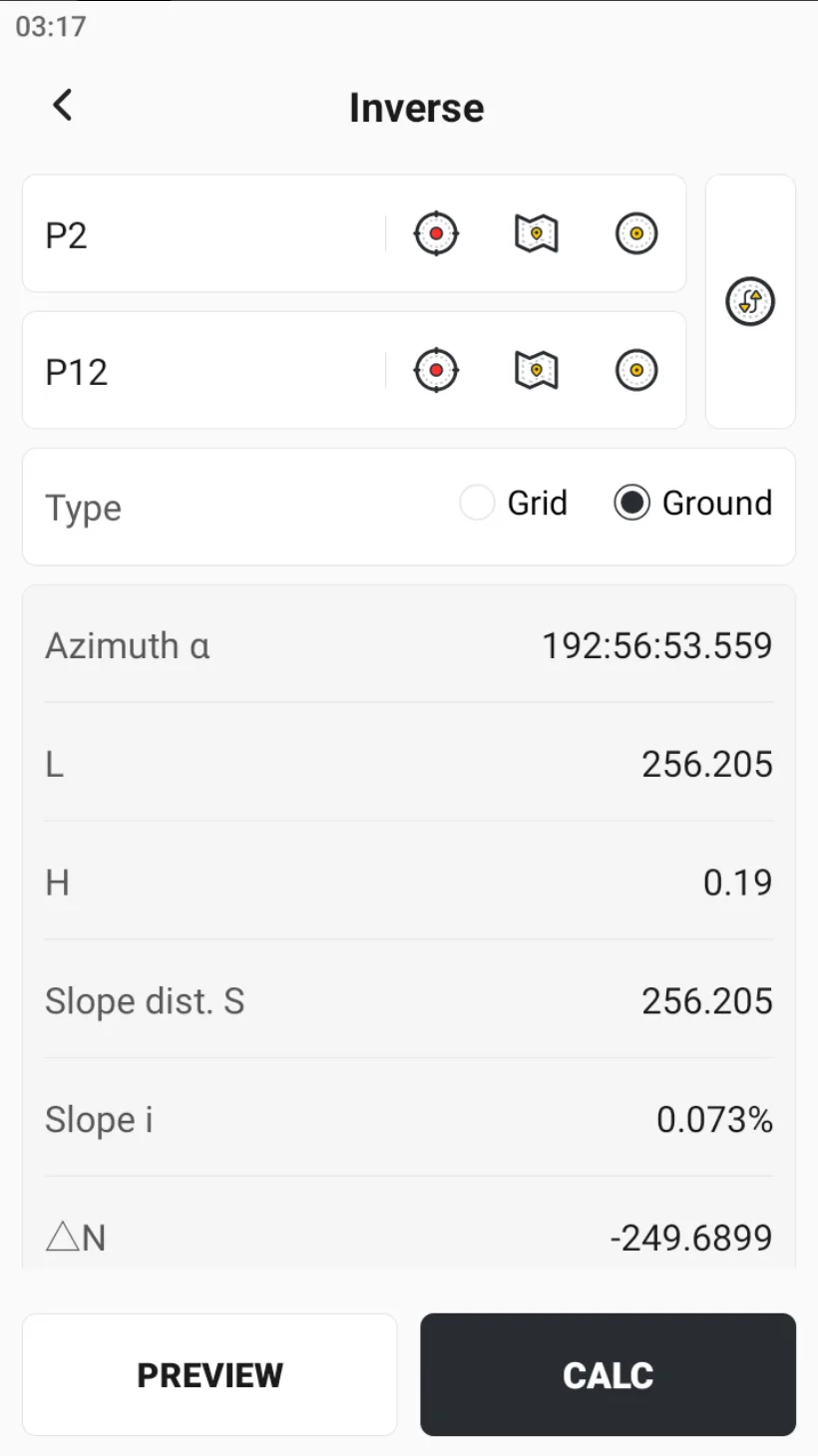
In the app, select the current location to calculate the grid factor, elevation factor, and comprehensive factor. After clicking [CALC] and [APPLY], return to [Inverse] to view the grid data and plane data of the selected distance.
 |  |  |